
The Geological Epic of Zion National Park
In order to fully appreciate the transformative potential of 3D maps within Zion National Park, it’s crucial to dive into the awe-inspiring geological history that has shaped this natural masterpiece. This rugged terrain, sculpted over countless eons by the ceaseless dance of the Virgin River, stands as a living confirmation to the profound forces of erosion and geological metamorphosis.
Millions of Years in the Making
The story of Zion’s formation begins millions of years ago when the area was submerged beneath a vast inland sea. Over time, sediment deposits accumulated, and the Earth’s crust heaved and folded, thrusting these ancient seabeds skyward. Erosion, acting as nature’s chisel, gradually began to carve out the intricate forms that we marvel at today.
Towering Sandstone Monoliths
Among the most striking features of Zion National Park are its towering sandstone cliffs, their russet hues glowing brilliantly in the desert sun. These colossal formations, like the famous Court of the Patriarchs and the Great White Throne, are composed of Navajo Sandstone, a geological wonder that tells tales of ancient desert dunes preserved in stone.
Narrow Slot Canyons and Hidden Wonders
Narrow slot canyons, such as The Narrows and Zion’s Subway, add an element of enchantment to the park’s geological diversity. These sinuous passageways, etched by water over millennia, offer glimpses into the subterranean world and showcase the artistry of water and time. 3D maps can unravel these labyrinthine passages and allow you to appreciate their intricate beauty.
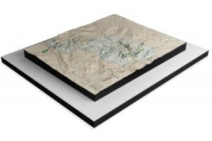
Zions National Park NPS 3D Map by WhiteClouds
Lush Oases and Ecological Riches
While the park’s rugged facade is its defining feature, hidden oases like the Emerald Pools and the verdant Zion Canyon provide a stark contrast to the harsh desert environment. The Virgin River, the lifeblood of the park, nourishes these lush pockets of greenery, serving as a sanctuary for a diverse range of plant and animal species. 3D mapping technology can help you explore these hidden ecosystems and their intricate relationships with the surrounding desert landscape.
Elevations and Ecological Zones
Zion National Park’s elevations span from 3,700 to 8,726 feet above sea level, creating a mosaic of distinct ecological zones. From the lower desert floors to the alpine heights of the park’s plateaus, each elevation harbors its unique flora and fauna. Detailed 3D maps provide a visual journey through these varying altitudes, allowing you to grasp the complexity of Zion’s ecosystems and how they adapt to changing conditions.
This geological masterpiece, shaped by time and the forces of nature, serves as the backdrop for the captivating world of 3D mapping, which promises to unlock new dimensions of exploration and understanding within Zion National Park.
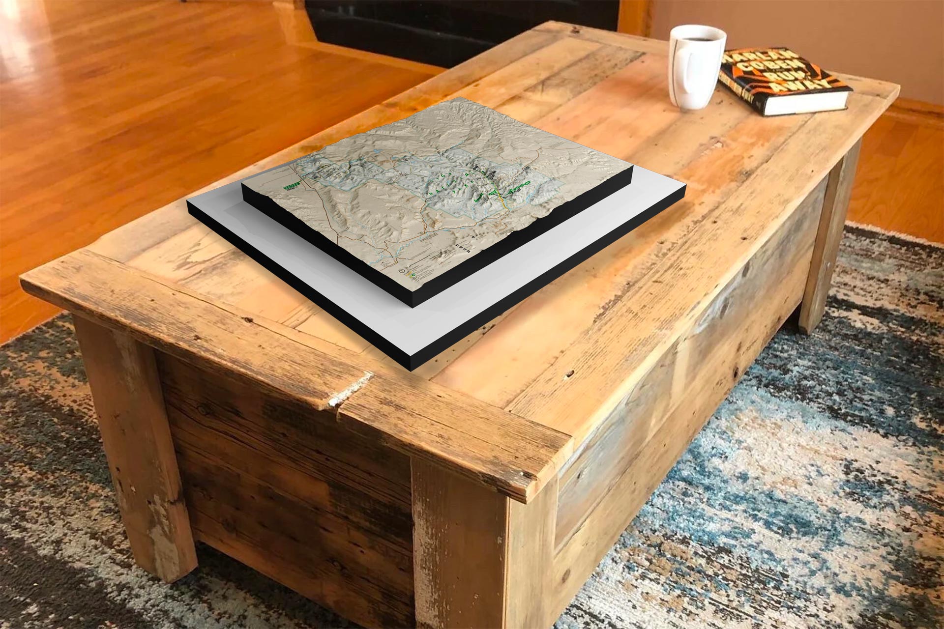
 Zions National Park NPS 3D Map
Data Acquisition: The Foundation of 3D Maps
At the core of any 3D map creation process is the acquisition of spatial data. This data forms the foundation upon which the 3D map is built. Several methods are commonly employed to gather this crucial information:
Aerial Imagery: Aerial photography and remote sensing techniques, including LiDAR (Light Detection and Ranging), capture high-resolution images and elevation data from airplanes or drones. LiDAR, in particular, provides detailed 3D point cloud data by measuring the distance between the sensor and the Earth’s surface.
Satellite Imagery: Satellite-based remote sensing technologies collect vast amounts of data covering large areas. This data includes color imagery, infrared imagery, and elevation data, allowing for a comprehensive view of the terrain.
Ground-Based Surveys: Surveyors use terrestrial LiDAR scanners, GPS technology, and other instruments to collect precise data from the ground. This data is often used to complement and refine aerial or satellite data.
Data Processing: Transforming Raw Data into 3D Models
Once the raw data is collected, it undergoes extensive processing to convert it into usable 3D models. This processing includes:
Data Alignment: Merging data from various sources and ensuring that it is accurately aligned in a common coordinate system is a crucial step. This alignment ensures that the 3D map accurately represents the real-world terrain.
Point Cloud Processing: For LiDAR data, point clouds are generated, where each point represents a specific location in 3D space. Filtering and classification algorithms are used to separate ground points from non-ground points (such as vegetation or buildings).
Mesh Generation: To create a more detailed 3D representation, the point cloud is converted into a mesh. This mesh consists of interconnected triangles that form the surface of the terrain.
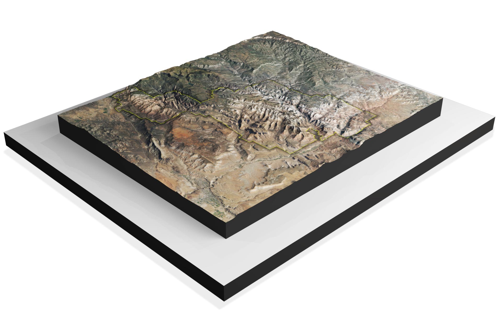
Texture Mapping: Aerial and satellite images are draped onto the 3D mesh to provide color and texture, making the map visually appealing and realistic.
Visualization and Interaction: Making 3D Maps User-Friendly
Creating a 3D map is not just about data; it’s about making it accessible and user-friendly. Here’s how:
User Interface Design: Designing an intuitive user interface is crucial to allow users to interact with the 3D map effectively. This includes navigation controls, search functions, and overlay options.
Web-Based Platforms: Many 3D maps are accessible through web-based platforms or dedicated apps, making them available to a wide audience via computers, smartphones, and tablets.
Customization: Users often have the ability to customize their 3D map experience by choosing different layers, map styles, and viewing options to suit their needs and preferences.
3D maps are a fascinating blend of data collection, processing, visualization, technology integration and a more immersive connection with the geological marvels of Zion National Park. Whether you’re standing before a monumental sandstone monolith or preparing to traverse a narrow ridge, these maps serve as trusted companions, unveiling the intricate beauty of Zion’s terrain and facilitating unforgettable adventures within its hallowed landscapes. They provide us with powerful tools for navigation, exploration, and understanding of our world, and they continue to evolve, offering new possibilities for both practical and recreational applications.
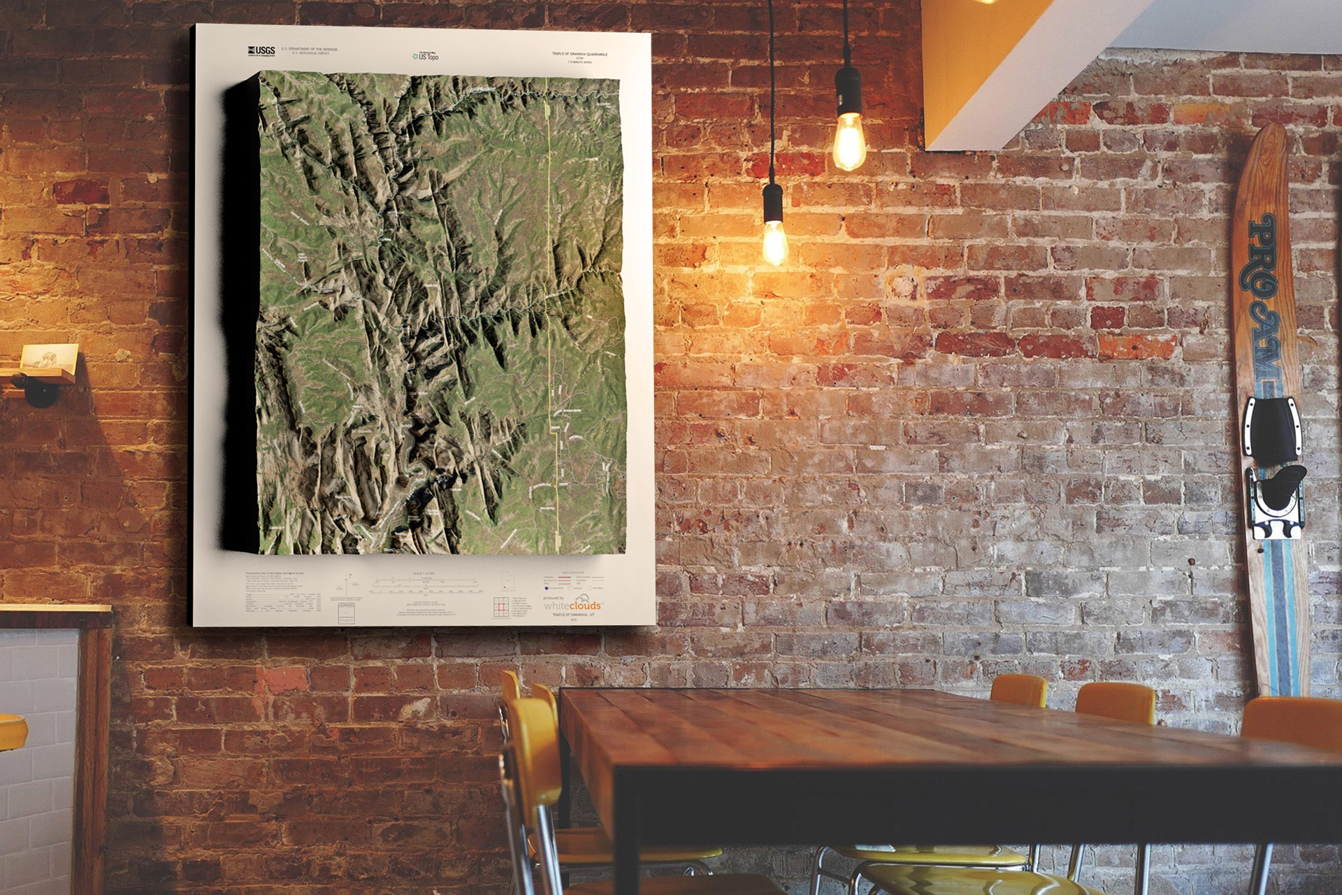 Zions National Park Satellite 3D Map – Temple of Sinawava
Conclusion
Zion National Park’s allure lies not only in its grandeur but also in the hidden treasures it harbors. With the aid of 3D mapping technology, these unique locations become more accessible and captivating, allowing visitors to plan their adventures with greater precision and appreciation. Whether you’re drawn to the challenging heights of Angel’s Landing or the serene beauty of Emerald Pools, these maps serve as a gateway to uncovering the park’s hidden wonders. Zion’s majesty awaits, now more accessible and mesmerizing than ever before, promising unforgettable experiences for all who venture within its red rock embrace.